イスラエル・イラン戦争:GPS干渉とタンカー衝突
2025年6月13日~2025年6月24日 · 紛争 · 最終更新:2026年11月10日
2025年6月のイスラエル・イラン戦争中、アナリストはペルシャ湾の約1,000隻でGPS干渉を報告しました。同海域では6月17日にタンカー二隻が衝突しました。
出典:GPSInterference.com、https://gpsinterference.com/ja/reports/2025-06-13-israel-iran-war-front-eagle。この出典表示とリンクを付ければ自由に再利用できます。
何が起きたか
イスラエルとイランは2025年6月13日から2025年6月24日まで、十二日間の戦争を行いました。[6]
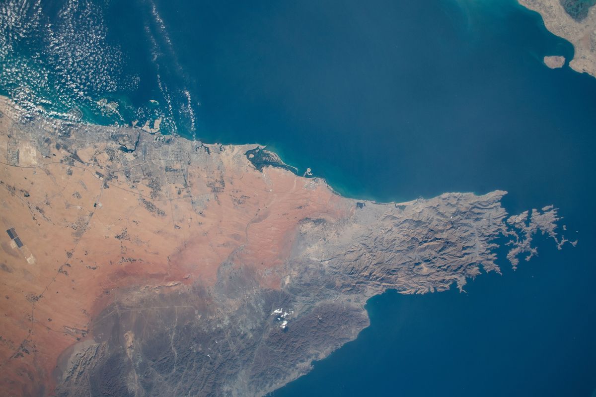
2025年6月17日、タンカーFront Eagleが、アラブ首長国連邦のホールファカンの北東約25海里でタンカーAdalynnと衝突し、Adalynnの乗組員24人が避難しました。[1]
Windwardは、Front Eagleがそれ以前から持続的なGPSとAISの干渉を受けており、6月12日から6月15日のあいだに同海域で約1,000隻が干渉の影響を受けたと述べました。[1]
Front Eagleを運航するFrontlineは、この衝突を紛争とは無関係の航行上の事案だとし、干渉が衝突を引き起こしたことを示した情報源はありません。[1][5]
当マップが示したこと
当マップは、GPSの位置精度が低いと報告した航空機を示します。誰が、または何が原因かは示しません。1日はUTCの丸1日のため、短時間の事象は薄まることがあります。
船舶はADS-BではなくAISを使うため、当マップが示すのは同じ海域の上空の航空機であり、船舶そのものではありません。
- 影響を受けた割合
- 94%
- 干渉の強い六角形
- 51個中48個
- 30日平均
- 48%
- 30日平均の2倍
確認したほかの地域
| 地域 | 日(UTC) | 割合 | 干渉が強い | 30日平均 |
|---|---|---|---|---|
| Gulf of Oman off Khor Fakkan | 2025年6月23日 | 90% | 21個中19個 | 0% |
高度別
| 高度 | 測定された六角形 | 干渉が強い | 割合 | 30日平均 |
|---|---|---|---|---|
| 5,000フィート未満 | 8 | 8 | 100% | 40% |
| 5,000~15,000フィート | 18 | 15 | 83% | 47% |
| 15,000~30,000フィート | 36 | 31 | 86% | 39% |
| 30,000フィート超 | 32 | 28 | 88% | 29% |
確認した各日
| 日(UTC) | 測定された六角形 | 干渉が強い | 割合 |
|---|---|---|---|
| 2025年6月13日 | 51 | 30 | 59% |
| 2025年6月14日 | 35 | 28 | 80% |
| 2025年6月15日 | 42 | 33 | 79% |
| 2025年6月16日 | 41 | 35 | 85% |
| 2025年6月17日 | 45 | 39 | 87% |
| 2025年6月18日 | 49 | 41 | 84% |
| 2025年6月19日 | 49 | 44 | 90% |
| 2025年6月20日 | 49 | 44 | 90% |
| 2025年6月21日 | 47 | 42 | 89% |
| 2025年6月22日 | 52 | 36 | 69% |
| 2025年6月23日 | 51 | 46 | 90% |
| 2025年6月24日 | 51 | 48 | 94% |
日ごとの推移
| 日(UTC) | 割合 |
|---|---|
| 2025年5月30日 | 51% |
| 2025年5月31日 | 59% |
| 2025年6月1日 | 43% |
| 2025年6月2日 | 43% |
| 2025年6月3日 | 40% |
| 2025年6月4日 | 48% |
| 2025年6月5日 | 41% |
| 2025年6月6日 | 44% |
| 2025年6月7日 | 47% |
| 2025年6月8日 | 40% |
| 2025年6月9日 | 51% |
| 2025年6月10日 | 53% |
| 2025年6月11日 | 49% |
| 2025年6月12日 | 56% |
| 2025年6月13日 | 59% |
| 2025年6月14日 | 80% |
| 2025年6月15日 | 79% |
| 2025年6月16日 | 85% |
| 2025年6月17日 | 87% |
| 2025年6月18日 | 84% |
| 2025年6月19日 | 90% |
| 2025年6月20日 | 90% |
| 2025年6月21日 | 89% |
| 2025年6月22日 | 69% |
| 2025年6月23日 | 90% |
| 2025年6月24日 | 94% |
| 2025年6月25日 | 77% |
| 2025年6月26日 | 24% |
| 2025年6月27日 | 10% |
| 2025年6月28日 | 3% |
| 2025年6月29日 | 5% |
| 2025年6月30日 | 12% |
| 2025年7月1日 | 39% |
動画
他者の見解
- Frontline
a navigational incident and not related to the current regional conflict
- UK Maritime Trade Operations
no indication that the incident was the result of hostile activity
- gCaptain
開戦以来、同海域で一日あたり約970隻がGPS干渉を受けていたと報じました。 - GPSwise
欧州と南アジア・東南アジアを結ぶ二つの航空回廊がいずれもGPS干渉の影響を受けていると述べました。 - Dana A. Goward
GPS navigation signals were being actively interfered with in the area at the time.
背景
- 地域のページ: イスラエル
- この日のページ: 2025年6月24日
- 考えられる原因: 紛争によるジャミング
出典
- Windward. GPS Jamming Falsely Placed VLCC Front Eagle in Iran Prior to Collision, 2025年6月17日.
- gCaptain, Mike Schuler. GPS Jamming in Strait of Hormuz Raises Maritime Safety Concerns After Tanker Collision, 2025年6月20日.
- Windward. Middle East on the Precipice: GPS Jamming in the Arabian Gulf and Strait of Hormuz Disrupts 970 Ships Daily, 2025年6月19日.
- GPSwise. Iran-Israel conflict: Civil aviation between a rock and a hard place, 2025年6月22日.
- Inside GNSS, Dana A. Goward. GNSS Interference in Ship Collision, Fires, Grounding, 2025年6月25日.
- Wikipedia. Twelve-Day War.
- Joint Maritime Information Center. JMIC Information Note 116, 17 June 2025, 2025年6月17日.
- The Guardian. Flying in the new age of conflict: the hotspots diverting flights and leaving pilots blind, 2025年6月24日.
このレポートを引用する
GPSInterference.com(2026). イスラエル・イラン戦争:GPS干渉とタンカー衝突. レポート, 2026年11月10日, 更新 2026年11月10日. https://gpsinterference.com/ja/reports/2025-06-13-israel-iran-war-front-eagle. データ:adsb.lol ADS-B、手法 v2。BibTeX
@misc{gpsinterference_2025_06_13_israel_iran_war_front_eagle,
  author = {{GPSInterference.com}},
  title = {Israel–Iran war: GPS interference and a tanker collision},
  year = {2026},
  howpublished = {\url{https://gpsinterference.com/reports/2025-06-13-israel-iran-war-front-eagle}},
  note = {Report, updated 2026-11-10. Data: adsb.lol ADS-B, method v2}
}